The recent coffee-table book by Swapna Liddle maps the architectural history of Delhi
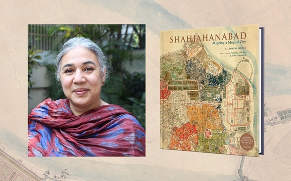
‘Shahjahanabad: Mapping A Mughal City’ by Swapna Liddle include detailed pull-up maps of various locations in Delhi which incite people interested in cartography & Delhi’s vibrant cultural history to lay their hands on this intriguing book.
There are various pull out map included in the map depicting the different locations of historical city:
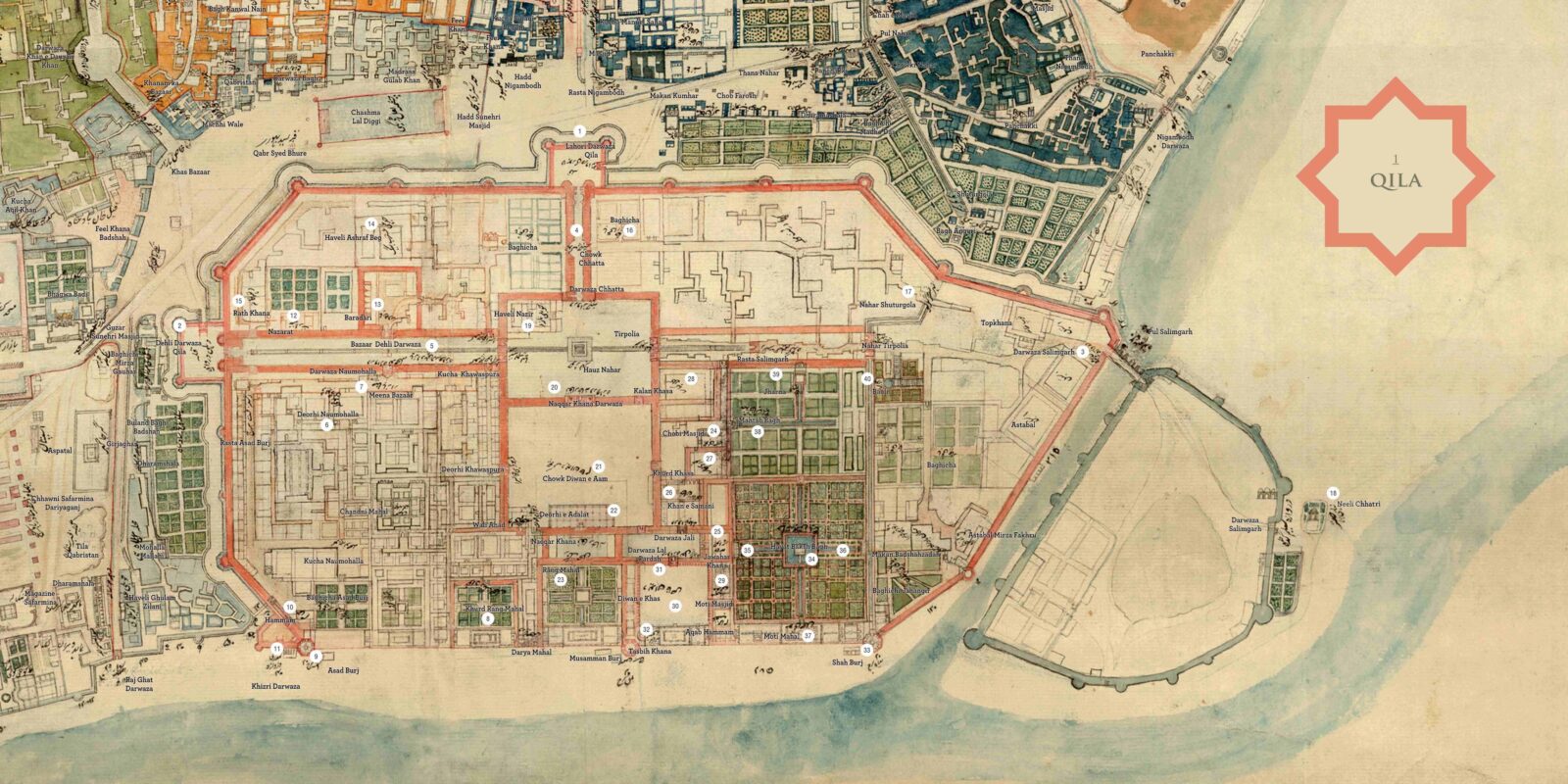
Qila: The citadel, referred to as Qila on the map, stands out prominently with its red enclosing walls clearly depicted. This is what we know today as Red Fort, though its formal name was Qila-e-Moalla, ‘the exalted fortress’. This was in a way the focal point of the new city of Shahjahanabad.
Dariba: The jurisdiction of this thana is marked out in orange, spreading north of Jama Masjid. An important landmark is the long street labelled Bazaar Dariba/Guzar Dariba (41), after which the thana is named. Though the map does not say so, Dariba was also called Dariba Kalan (‘big Dariba’) and a street going off it, to the west, was called Dariba Khurd.
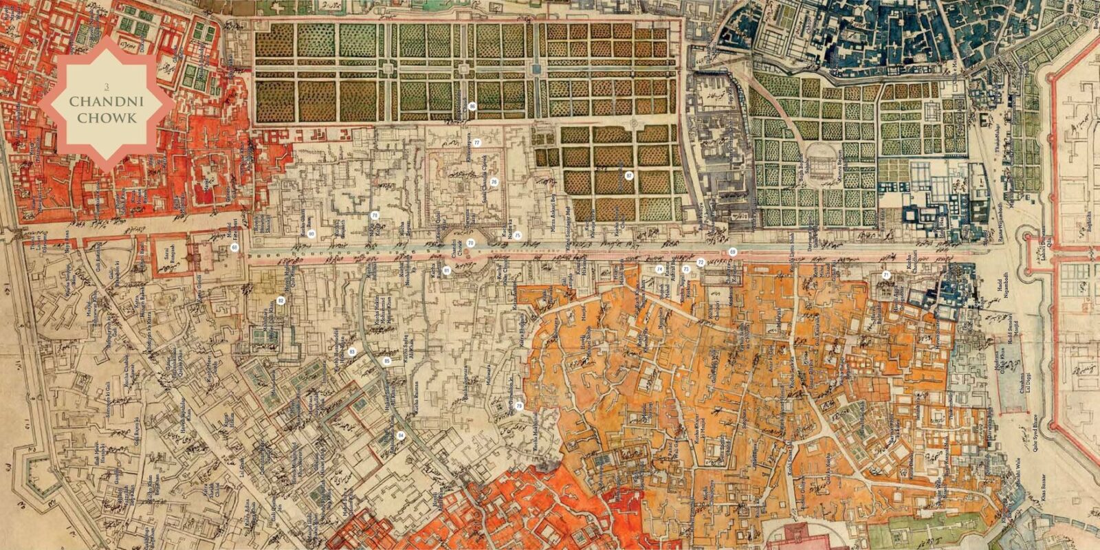
Chandni Chowk: The Chandni Chowk thana is the most spread out of all the thanas of the city. Its limits include the most important street of the city, running from the Lahori Darwaza of the Qila, to Fatehpuri Masjid (68) at its western end. It is interesting to note, however, that the thana limits actually exclude a short stretch at the extreme eastern end of the street.
Bhojla Pahadi: The area stretching south of the Jama Masjid is coloured in green, and marked in the 1858 plan as Bhojla Pahadi. The most prominent landmark within this thana limit is the Jama Masjid (88), drawn in beautiful detail. This mosque had been built as the congregational mosque of the city of Shahjahanabad at the time of its founding, and was located on the highest point in the city.
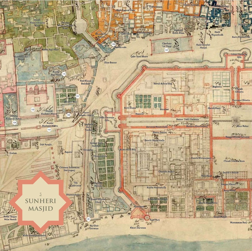
Sunehri Masjid: This is a small jurisdiction of the city, marked at its boundary as Hadd Sunehri Masjid, ‘boundary Sunehri Masjid’, though the 1858 plan refers to this thana as Raj Ghat. The vast majority of the buildings in this part of the city were demolished post-1857, so the map is a valuable source of information for what existed here before the destruction.
Turkman Darwaza: This rather compact thana, coloured brown in the map, gets its name from the Turkman Darwaza (125), one of the gates piercing the city wall. Though the gate was built in the seventeenth century, along with the wall encircling the city of Shahjahanabad, it was named after a much older shrine in its vicinity. This was the Dargah of Shah Turkman ‘Biyabani’ (126), a Sufi saint who had died in 1240 and was buried here.
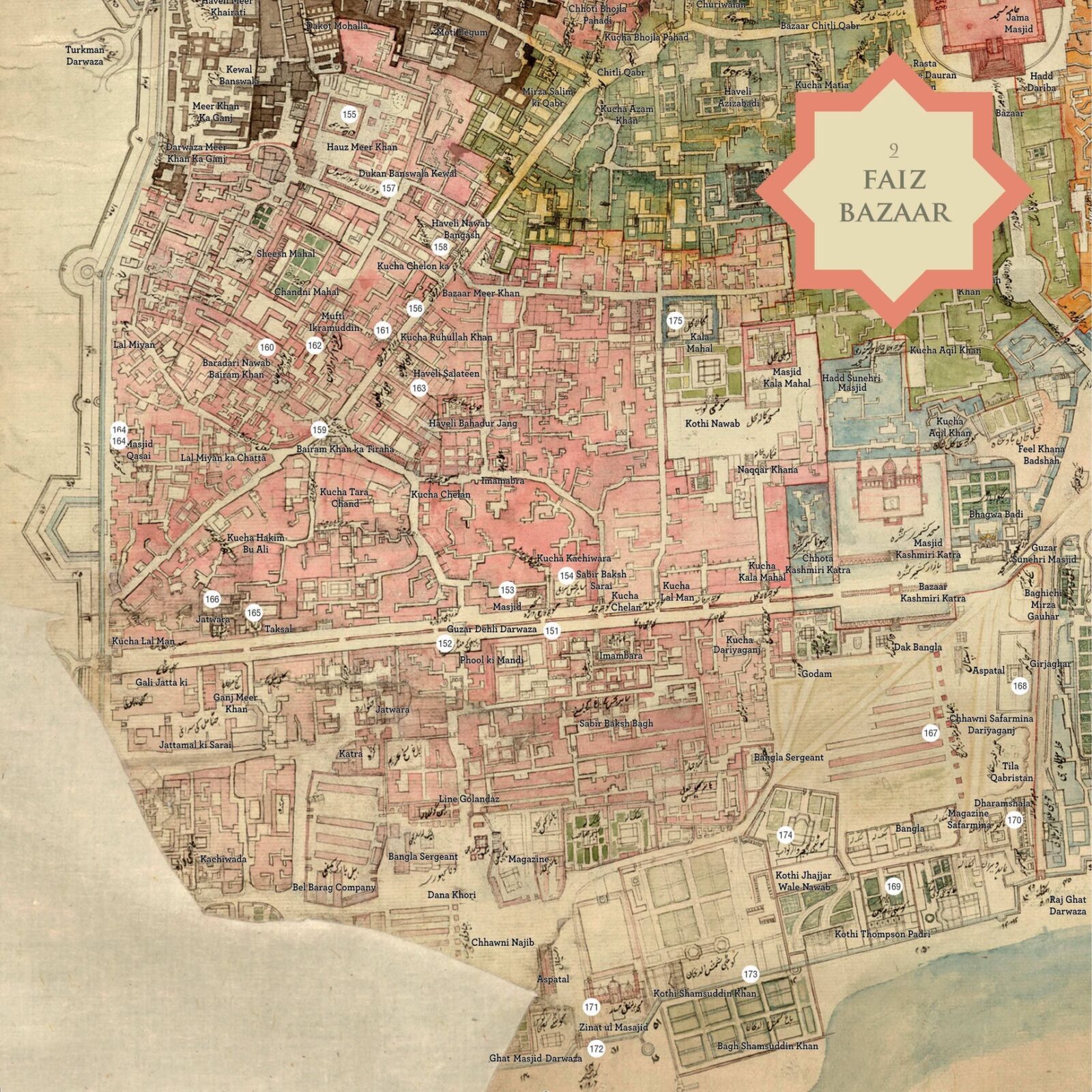
Faiz Bazaar: The area called Faiz Bazaar when this map was made, is now better known to us as Dariyaganj. The thana limits are quite extensive, as it spreads out from just south of the Qila, to the southernmost gate of the city, that is, Dehli Darwaza. Its east to west spread is from the bank of the Yamuna westward to its boundaries with two other thanas – Turkman Darwaza and Bhojla Pahadi.
Guzar Lahori Darwaza: The ceremonial avenue running westwards from the Lahori Darwaza of the Qila, stops short in front of the Fatehpuri Masjid. The distance between this place and the Lahori Darwaza (176) of the city, which lay further west, was covered by another, much shorter but almost equally broad street – the Guzar Lahori Darwaza.

Kashmiri Darwaza: The area covered within these thana limits stretches from near Dariba in the south, all the way to the Kashmiri Darwaza (196), the northernmost gate of the city. The thana can be divided into distinct areas, each with a very different character, from the commercial spaces across from Dariba, to the large mansions overlooking the river in the north. The southern end of the thana is narrow, accessed through a street that opens to the Kotwali Chowk, and is marked in the map as Rah Kaudiya Pul ko, banam Tirpolia, that is, ‘road to Kaudiya Pul, namely Tirpolia’.
Ajmeri Darwaza: This thana, coloured saffron on the map, gets its name from one of the gates in the city wall – Ajmeri Darwaza. Its primary landmark however, is a crossroads, at the junction of two major arteries. One of these leads from the Jama Masjid to the Ajmeri Darwaza, and the other, from the vicinity of Lahori Darwaza to Turkman Darwaza.